Risk-based zoning and siting for aquaculture
DESCRIPTION
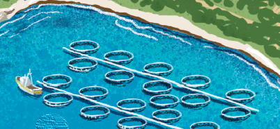
Aquaculture is a key sector for the blue economy in the Adriatic-Ionian Region, with a significant potential for increasing development. In the European Union Strategy for the Adriatic and Ionian Region (EUSAIR) aquaculture is considered as one of the most promising activities of all coastal countries of the region. Despite this high potential, the Adriatic Sea area is currently intensively crowded by a number of other maritime and coastal activities (e.g. coastal and maritime tourism, transport of goods and passengers, fisheries, offshore gas exploitation, energy and communication cables) that need to be properly taken into account through coordinated spatial planning when a new aquaculture site is being developed in order not to create conflicts and to find a suitable space.
Spatial planning for marine aquaculture, including risk-based zoning and siting, aims at ensuring the most equitable use of the marine space for this activity, supporting production, minimising conflicts with other uses and maintaining environmental integrity. It also requires proper understanding of climate-related risks in a changing climate. Changes in sea temperature and salinity, freshwater inflows and nutrient-rich salts can have both positive and negative effects on mariculture (PAP/RAC, 2015) favouring, for example, thermophilic species but also the arrival of new species from warmer seas, that may become invasive. In this regard, recent impairment of mussel production has been already locally experienced in the Adriatic aquaculture sector, due to peak summer temperatures that led to lower quality of farmed mussels and due to strong storms and waves causing structural damage to the farms. Other climate-related risks include slow onset effects responsible for changing of physical-chemical conditions of seawater (e.g. increasing average temperatures, salinity changes, acidification) and related indirect impacts such as disease diffusion, harmful algae blooms, hypoxia, and pollution from increased runoff waters.
Marine aquaculture zoning and siting through an ecosystem approach, which also consider the effects of climate variability and change, is encouraged by FAO (FAO, 2018, FAO, 2017). Appropriate site selection supported by a flexible regulatory framework is also suggested as adaptation strategy in the case studies of the Horizon 2020-funded ClimeFish project, aiming at ensuring that the increase in seafood production comes in areas and for species where there is a potential for sustainable growth, given the expected changes in climate.
Risk-based zoning and siting can help avoid areas particularly vulnerable to climate risks and select the most suitable areas for the cultured species, considering both the current state and the challenges posed by the climate change in the medium-long term. The overall process allows for minimizing of possible economic losses that could derive from choices that do not take into account all risks and concerns.
In order to define allocated zones for aquaculture (AZA, zoning step) and specific locations suitable for new farming activities (siting step), a complete analysis of main threats for a successful production should be performed. Climate-related risks figure among other non-climate related risks including, for example, the environment (pollution) health (biosecurity) and social conflicts. A review of local climate conditions (historical data), of risks posed by climate variability (e.g. storms) and of long term trends (e.g. rising temperature and change in salinity) is recommended. The lack of a long historical dataset of climate variables and uncertainties in regional and sub-regional projections of climate change can limit the possibility to properly include the climate change and variability assessment in risk-based zoning and siting for aquaculture.
A wide variety of spatial tools and models exist (FAO, 2017) which can support marine aquaculture zoning. The EU H2020 funded research projects Aquaspace and TAPAS delivered toolboxes to help and support the purpose of making more high-quality space available for aquaculture. The Aquaspace specifically included a case study located in the Northern Adriatic Sea providing evidence for a science-based process for site selection for shellfish farming.
The identification of relevant stakeholders for consultation during all the steps of aquaculture spatial planning is a central task in order to identify issues and potential conflicts with other uses and the environment. Benefits can be derived from initiatives such as the ITAQUA platform, a shared working environment for various stakeholders to increase and improve competitiveness of the Italian aquaculture. The participation of all relevant stakeholders is encouraged by the European Commission that also identified coordinated spatial planning among priority areas for a sustainable development of aquaculture.
COSTS AND BENEFITS
Risk based zoning and siting of the aquaculture sector is aimed at avoiding economic losses due to selection of sites unsuitable because of adverse climate conditions and vulnerability to climate change. If climate-related risks are properly included in the analysis, aquaculture sites could be spared short-term and long-term climate-related threats (e.g. loss of production or infrastructure due to extreme events, diseases, toxic algae and parasites, lower quality of production).
Costs include the use of tools and the implementation of models needed within the whole process of aquaculture spatial planning. Costs refer both to the software licence (if not open-source) and to the human resources and time needed to get enough technical skills and training to use the tools. Within the Aquaspace project, the tools-associated cost was highlighted as the most frequent weak element in the SWOT analysis performed to evaluate overall tools and methods implemented and tested in the project case studies.
IMPLEMENTATION TIME AND LIFETIME
Spatial analysis requires a limited investment of time (typically 1-2 years), if tools and data are already available. The whole process, involving stakeholder consultation and final decision making, can be more time consuming, especially in areas, such as the Adriatic Sea, already hosting a number of other activities, potentially creating social and economic conflicts. Zoning and site selection should be an adaptive process, able to respond to new scientific progress in the field of climate variability and change.
SOURCE FOR MORE DETAILED INFORMATION
FAO, (2018). Impacts of climate change on fisheries and aquaculture. Synthesis of current knowledge, adaptation and mitigation options. FAO, Fisheries and Aquaculture Technical paper. ISSN 2070-7010 627.
FAO, (2017). Aquaculture zoning, site selection and area management under the ecosystem approach to aquaculture.